【中文介绍】
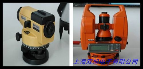
TDJ2 2秒倒像经纬仪是一款专为高精度大地测量设计的专业光学仪器,适用于地形测绘、工程放样、地质勘探等领域。该设备采用先进的光学成像技术,内置高对比度倒像系统,可快速获取清晰的测量标靶影像,有效提升复杂环境下的观测效率。其测角精度达到2秒级,水平角与竖直角测量误差均控制在行业高标准范围内,满足各类工程项目的精细化测量需求。
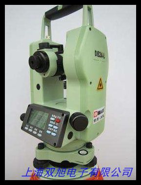
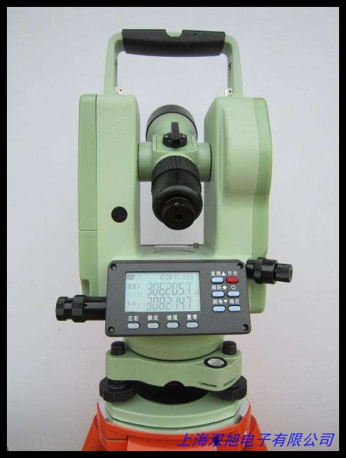
仪器主体采用高强度合金框架与精密机械结构设计,兼顾轻量化与耐用性。核心部件配备多层镀膜物镜和防雾光学玻璃,即使在-20℃至+50℃的极端温差环境下仍能保持稳定的成像质量。人性化的操作界面配备双向微动螺旋和激光对点装置,支持单人多角度快速调平,显著缩短现场作业准备时间。此外,可拆卸式三脚架兼容多种地形支架接口,便于在野外复杂地面快速搭建观测平台。
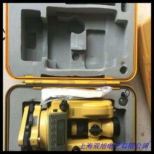
本产品特别优化了数据处理流程,测量结果可通过蓝牙模块直接传输至移动终端,兼容主流测绘软件格式,实现外业测量与内业制图的无缝衔接。标配防震收纳箱和便携式充电组件,确保设备在长途运输和长期野外作业中的可靠性。适用于土木工程、矿山监测、道路施工、水利建设等多种场景,为专业测量团队提供高效精准的解决方案。
【English Introduction】
The TDJ2 2-second optical theodolite is a precision surveying instrument designed for high-accuracy geodetic measurements, ideal for topographic mapping, engineering layout, and geological exploration. Equipped with an advanced inverted-image optical system, it delivers high-contrast target imaging capabilities that significantly enhance observation efficiency in challenging environments. With angular measurement accuracy of 2 seconds, both horizontal and vertical angle measurement errors are maintained within rigorous industry parameters, ensuring reliable performance for precision engineering applications.
Featuring a lightweight yet durable aluminum alloy frame, the instrument integrates multi-layer coated objective lenses and anti-fog optical components. Its temperature-resistant design guarantees stable operation across extreme conditions from -20℃ to +50℃. The user-centric interface includes dual-axis fine motion screws and a laser plummet, enabling single-operator leveling adjustments within 30 seconds. The detachable tribrach system supports multiple terrain-adaptive tripod interfaces, allowing rapid deployment on uneven ground surfaces.
This theodolite streamlines workflow through Bluetooth-enabled data transmission to mobile devices, compatible with major CAD and GIS platforms for seamless field-to-office data integration. The shockproof carrying case and portable power kit ensure equipment protection during extended field operations. Suitable for civil engineering, mine monitoring, road construction, and hydraulic projects, it provides survey professionals with an optimized combination of optical performance and operational efficiency. The modular design allows easy maintenance and accessory upgrades, extending equipment service life across diverse project cycles.